December 9, 2024 by Stephanie G Seay, Oak Ridge National Laboratory
Collected at: https://phys.org/news/2024-12-urban.html
Scientists at the Department of Energy’s Oak Ridge National Laboratory have developed a first-ever urban heat wave simulation that takes into account the compounding effects from building infrastructure. The method provides a more accurate picture of the impacts from excessive heat on at-risk populations, which can guide local planners seeking mitigation solutions.
Heat kills more people than any other form of extreme weather. Heat waves are running hotter and lasting longer, with new, unenviable records set in highly populated cities. Las Vegas, Nevada, recorded its hottest-ever temperature of 120 degrees Fahrenheit on July 7, while also marking seven consecutive days with highs of 115 degrees or more. The June through August 2024 period was the Northern Hemisphere’s hottest meteorological summer on record, at 2.74 degrees Fahrenheit above average, according to the U.S. National Oceanic and Atmospheric Administration.
Compounding the effect of higher temperatures in cities is the presence and design of building infrastructure. Buildings can affect wind speed and direction, absorb solar radiation, and reduce the transfer of heat out of a system. Representing those details is crucial for an accurate simulation that can guide decision-making.
“There is a lot of sharing of heat among buildings. That can be advantageous in the winter, but in the summer if you’re retaining that much heat in a neighborhood, it can amplify a heat wave,” said ORNL’s Melissa Dumas, who led the modeling work. “If you don’t have those buildings represented in your model, then you can’t understand what that amplification is and how it compounds urban heat islands.”
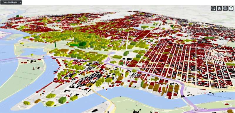
The scientists tested their approach by modeling a July 2010 heat wave in Washington, D.C., where temperatures hit a maximum of 102 degrees.
They found that adding details on the presence, proximity, structure and design of buildings significantly improved their modeling of temperature, relative humidity and heat fluxes across the city, as described in the journal npj Urban Sustainability.
The results showed that including building data provided a significantly more accurate simulation, particularly for the city’s most at-risk neighborhoods. The simulations without building data erred on the cool side, the scientists found.
“We found that the neighborhoods with the lowest average income were the most adversely affected by the heat wave—something we would not have been able to determine without this building data,” Dumas said. The level of detail for the buildings ranged from 10 meters to 100 meters to 1 kilometer and covered the entire area under study, providing a 3D representation of the structures’ thermal implications from the structures.
“Getting information at this resolution allows us, for the first time, to quantitatively analyze the impacts of excessive heat on specific neighborhoods,” Dumas said. “The result is a weather model that contains all the meteorological processes and also lets us examine the interaction of how buildings are sited and what the impact is for the people who live in those dwellings.”
“As new neighborhoods are built, knowing the building height, placement and footprint that leads to an energy efficient system, even before thinking about HVAC, is an important factor that city planners can glean from a model that includes these parameters and then incorporate in their decision-making,” Dumas said.
The scientists created an open-source tool that allows users to generate custom models using local data. The software is further described in the Journal of Open Source Software.
Other scientists who worked on the project include Joshua New of ORNL, Brett Bass, currently at Procter & Gamble; Levi Sweet-Breu, currently at Baylor University; Christa Brelsford, currently at Los Alamos National Laboratory; and Linying Wang of Boston University.
More information: Melissa R. Allen-Dumas et al, Sensitivity of mesoscale modeling to urban morphological feature inputs and implications for characterizing urban sustainability, npj Urban Sustainability (2024). DOI: 10.1038/s42949-024-00185-6
Levi T. Sweet-Breu et al, naturf: a package for generating urban parameters for numerical weather modeling, Journal of Open Source Software (2024). DOI: 10.21105/joss.06712

Leave a Reply