August 19, 2024 by European Space Agency
Collected at: https://phys.org/news/2024-08-satellite-power-ai-earth.html
Φsat-2, ESA’s groundbreaking cubesat designed to revolutionize Earth observation with artificial intelligence, has launched.
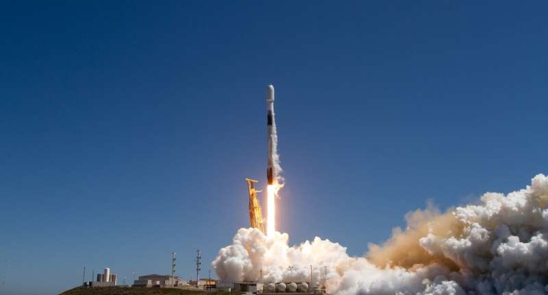
The cubesat embarked on its journey into space on 16 August at 20:56 CEST (11:56 local time) on board a SpaceX Falcon 9 rocket from the Vandenberg Space Force Base in California, U.S., integrated by Exolaunch as part of the Transporter-11 rideshare mission, which also included ESA’s Arctic Weather Satellite.
At 21:50 CEST, Φsat-2 deployed from the launch vehicle and at 23:47 CEST the Svalbard ground station in Norway received the important signal indicating that Φsat-2 is now safely in orbit.
Φsat-2 will push the boundaries of Earth observation, demonstrating how AI technologies can be used to advance how we observe Earth from space. The miniature satellite is equipped with a state-of-the-art multispectral camera and a powerful AI computer that analyzes and processes imagery while in orbit. This will prove critical for disaster response efforts, maritime monitoring, environmental protection and more.
ESA’s Director of Earth Observation Programs, Simonetta Cheli, commented, “We are thrilled today to launch Φsat-2, which will demonstrate the transformative power of artificial intelligence in Earth observation. This mission heralds a new era of actionable insights from space, promising smarter and more efficient ways of monitoring our planet.”
Nicola Melega, ESA’s Φsat-2 Technical Officer, added, “The Φsat-2 mission shows how advanced AI technology can transform our ability to monitor and respond to changes on Earth, making space data more actionable and impactful than ever before.”
A new era of artificial intelligence
AI has significantly enhanced the way our planet is monitored and understood. AI capabilities allow for satellite data to be processed quickly and accurately—transforming vast amounts of raw data into actionable insights for scientists, businesses and policymakers.
While most AI processing occurs on the ground after the data has been downloaded, ESA’s Φsat-2 satellite will do this in real-time. Instead of downlinking large amounts of raw data, including those obscured by clouds, the onboard apps can process these images directly, ensuring that only the most essential information is sent back to Earth. This innovation gives tangible benefits, enhances data transmission and accelerates decision making.
Orbiting Earth at an altitude of 510 km, the satellite’s multispectral camera images Earth in seven different bands in the visible to near-infrared part of the electromagnetic spectrum. The 6U Cubesat platform, designed and developed by OpenCosmos, runs AI apps that can be easily installed and operated remotely from Earth.
These apps can provide actionable data for environmental protection and set a new standard in space-based AI technology. At launch, Φsat-2 runs the following apps on board:
- Cloud detection.Unlike traditional satellites that downlink all captured images, including those obscured by clouds, Φsat-2 processes these images directly in orbit, ensuring that only clear, usable images are sent back to Earth. Developed by KP Labs, this application can also classify clouds and provide insights into cloud distribution. This gives users more flexibility when it is time to decide whether an image is usable or not.
- Street map generation.The Sat2Map application, developed by CGI, converts satellite imagery into street maps. This capability is particularly beneficial for emergency response teams, enabling them to identify accessible roads during disasters such as floods or earthquakes. When the satellite orbits over the affected area and acquires images, the images are passed to the onboard processer that will identify streets and generate a corresponding map. Initially, this application will be demonstrated over Southeast Asia, showcasing its potential to aid in crisis management.
- Maritime vessel detection.The maritime vessel detection application, developed by CEiiA, utilizes machine learning techniques to automatically detect and classify vessels in specified regions, facilitating the monitoring of activities like illegal fishing. This application underscores the satellite’s role in supporting maritime security and environmental conservation efforts.
- On-board image compression and reconstruction. Developed by GEO-K, this application is responsible for compressing images on board. By significantly reducing file sizes, this application increases the volume and speed of data downloads. After being downlinked to the ground, the images are reconstructed using a dedicated decoder. The first demonstrations of this technology will occur over Europe, focusing on the detection of buildings.
Leave a Reply