August 26, 2024 by Shanghai Astronomical Observatory, Chinese Academy of Sciences
Collected at: https://techxplore.com/news/2024-08-precision-orbit-overhaul-leo-satellites.html
Global Navigation Satellite System (GNSS) accuracy is crucial for precise applications, yet regional networks often face challenges in maintaining this precision. Integrating data from Low Earth Orbit (LEO) satellites with ground stations offers a promising solution to these challenges. Given these limitations, there is a clear need to explore more effective methods of GNSS orbit determination.
On August 12, 2024, researchers from the Shanghai Astronomical Observatory, Chinese Academy of Sciences, published a study in Satellite Navigation demonstrating that integrating regional ground station data with LEO satellite measurements significantly improves Global Positioning System (GPS) orbit determination.
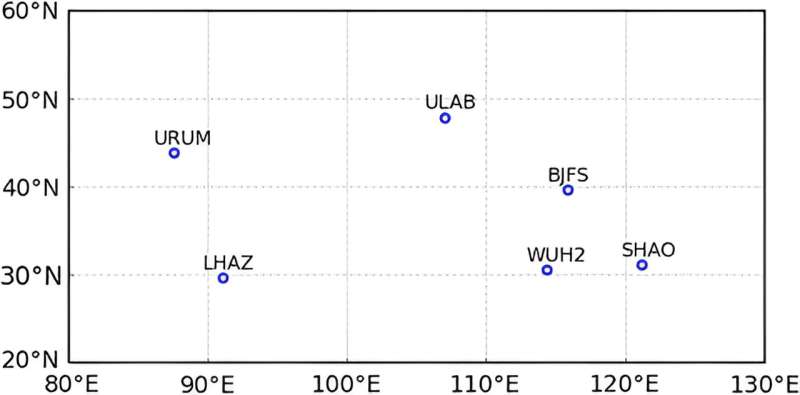
The study analyzed data from January 20 to 26, 2019, involving 13 LEO satellites and six International GNSS Service stations across China. The findings indicate that this approach can achieve centimeter-level accuracy in GPS orbit and clock products, which is crucial for high-precision GNSS applications.
This study enhances GPS orbit determination by integrating regional ground station data with measurements from 13 LEO satellites. Conducted by the Shanghai Astronomical Observatory, the research utilized six GNSS stations around China and LEO satellites from missions such as GRACE Follow-On, SWARM, Sentinel, Jason and China meteorological satellites.
The integration method significantly improved GPS orbit accuracy, achieving average errors of 2.27 cm in the radial direction, 3.45 cm along-track, and 3.08 cm cross-track, with clock accuracy better than 0.15 nanoseconds. The LEO satellites also demonstrated high precision, with most errors within 4 cm.
This approach showcases the potential of LEO satellites to enhance GNSS accuracy, especially in regions with limited ground station coverage, offering a robust solution for achieving high-precision GPS orbit and clock products crucial for various applications.
Dr. Chengpan Tang, the lead researcher from the Shanghai Astronomical Observatory, says, “Integrating LEO satellite data with regional ground stations provides a practical solution to the challenges of high-precision orbit determination in GNSS. Our findings suggest that this approach can deliver reliable orbit and clock products, which are vital for a broad range of applications, from navigation to Earth observation.”
The integration of LEO satellites with regional ground stations marks a significant advancement in GNSS technology. This method not only improves the accuracy of GPS orbit determination but also opens up new possibilities for high-precision applications, particularly in regions with sparse ground station coverage.
As LEO satellite constellations continue to expand, this approach could become standard practice, ensuring more reliable and accurate GNSS services worldwide.
More information: Kai Li et al, High-precision GPS orbit determination by integrating the measurements from regional ground stations and LEO onboard receivers, Satellite Navigation (2024). DOI: 10.1186/s43020-024-00147-4
Leave a Reply