August 6, 2024 by Marni Ellery, University of California – Berkeley
Collected at: https://phys.org/news/2024-08-vision-based-seasonal-dynamics-tropical.html
Understanding how water moves and changes around the world is more important than ever due to climate change, but monitoring inland water in the tropics is not easy. Most satellites are optical and simply take photos of surfaces. They cannot see through the thick cloud cover and dense vegetation that conceal the rivers, lakes and wetlands below.
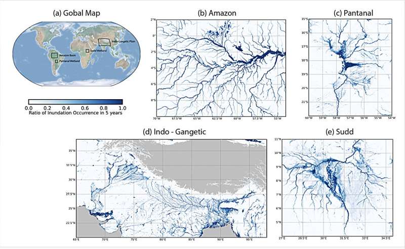
Now, a team led by UC Berkeley researchers has developed a new way to map water on land in the tropics. Called the UC Berkeley Random Walk Algorithm WaterMask (Berkeley-RWAWC), this advanced monitoring technology uses L-band microwaves from the Cyclone Global Navigation Satellite System (CYGNSS) to “see” water hidden beneath visual barriers, like tree canopies and clouds. It also incorporates a computer vision algorithm that works with CYGNSS data to differentiate between land and water.
In a study recently published in Water Resources Research, the researchers used Berkeley-RWAWC (pronounced like “rock”) to generate a detailed monthly map of water bodies from 37.4°N to 37.4°S, showing where water is and how it changes over time. Their findings provide a clearer picture of seasonal water dynamics in these regions.
“Using Berkeley-RWAWC, we can better understand seasonal and yearly changes in tropical water,” said Tianjiao Pu, first author of the study and a Ph.D. student in the Department of Civil and Environmental Engineering. “The monthly map provides fresh insights into these vital ecosystems, helping to close the gap in tropical water monitoring.”
According to Pu, the data provided by Berkeley-RWAWC is particularly critical to people living in the tropics. These communities tend to be the most impacted by climate change and need help preparing for and responding to floods and droughts.
“By understanding the dynamics of water distribution, we can better prepare for the challenges posed by climate change, protect natural ecosystems and support the communities that depend on them,” she said.
One way researchers aim to help these communities is by using Berkeley-RWAWC to track floods to improve hydrologic models. “The Sudd wetlands in South Sudan, for example, have been experiencing catastrophic floods for multiple years in a row, displacing over a million people and adding to an already dire situation in the region,” said Cynthia Gerlein-Safdi, the study’s principal investigator and a professor of civil and environmental engineering.
“Improved maps of flooding in the area can provide new tools for humanitarian aid to be released ahead of the next flood event.”
Berkeley-RWAWC also can be used to model greenhouse gas emissions in tropical wetlands. According to Gerlein-Safdi, these wetlands are natural emitters of methane, but as climate change warms the planet, the wetlands start emitting more and more methane, creating a positive feedback loop.
“Berkeley-RWAWC improves the mapping of where and how big these wetlands are, allowing other scientists to then predict the trajectory of these wetlands and their methane emissions as the climate warms,” she said.
Already, Berkeley-RWAWC is revealing strong seasonal patterns in water dynamics and providing researchers with a deeper understanding of water-related topics in tropical regions. With this information, they can devise ways to improve flood prediction, water resource management and climate change mitigation strategies.
“By uncovering these patterns, our work enhances our ability to monitor and respond to environmental changes in the tropics,” said Gerlein-Safdi.
More information: Tianjiao Pu et al, Berkeley‐RWAWC: A New CYGNSS‐Based Watermask Unveils Unique Observations of Seasonal Dynamics in the Tropics, Water Resources Research (2024). DOI: 10.1029/2024WR037060
Journal information: Water Resources Research

Leave a Reply